Where to Find a Trilateration Surveying Data Processing Program
To obtain a trilateration surveying data processing program click here to visit our download store. Look for “WinTri – A Computer Program for Trilateration” in the “Surveying” category to find it. This standalone program can be used for data reduction in connection with trilateration surveys. You can buy this convenient data reduction program for trilateration surveys for a very reasonable price (only $79.95).
Introduction to WinTri – A Trilateration Surveying Data Processing Program
WinTri is a standalone computer program (not a spreadsheet) for trilateration surveying data processing. It can be used for reduction of data from trilateration surveys; in particular WinTri calculates the coordinates of stations. The program is general in that it will handle any surveying control figure that a user might specify. Data validation is a key feature of the program. Input data from surveys are extensively checked for errors, and warning messages are displayed on the screen when an error is encountered. In calculating results, WinTri employs least-squares adjustment.
Win-Tri Help screens provide complete, annotated examples of all required input files. Sufficient explanation is given so that someone who has never used the program before can prepare all input data solely by studying the Help screens.
How to Use WinTri – A Trilateration Surveying Data Processing Program
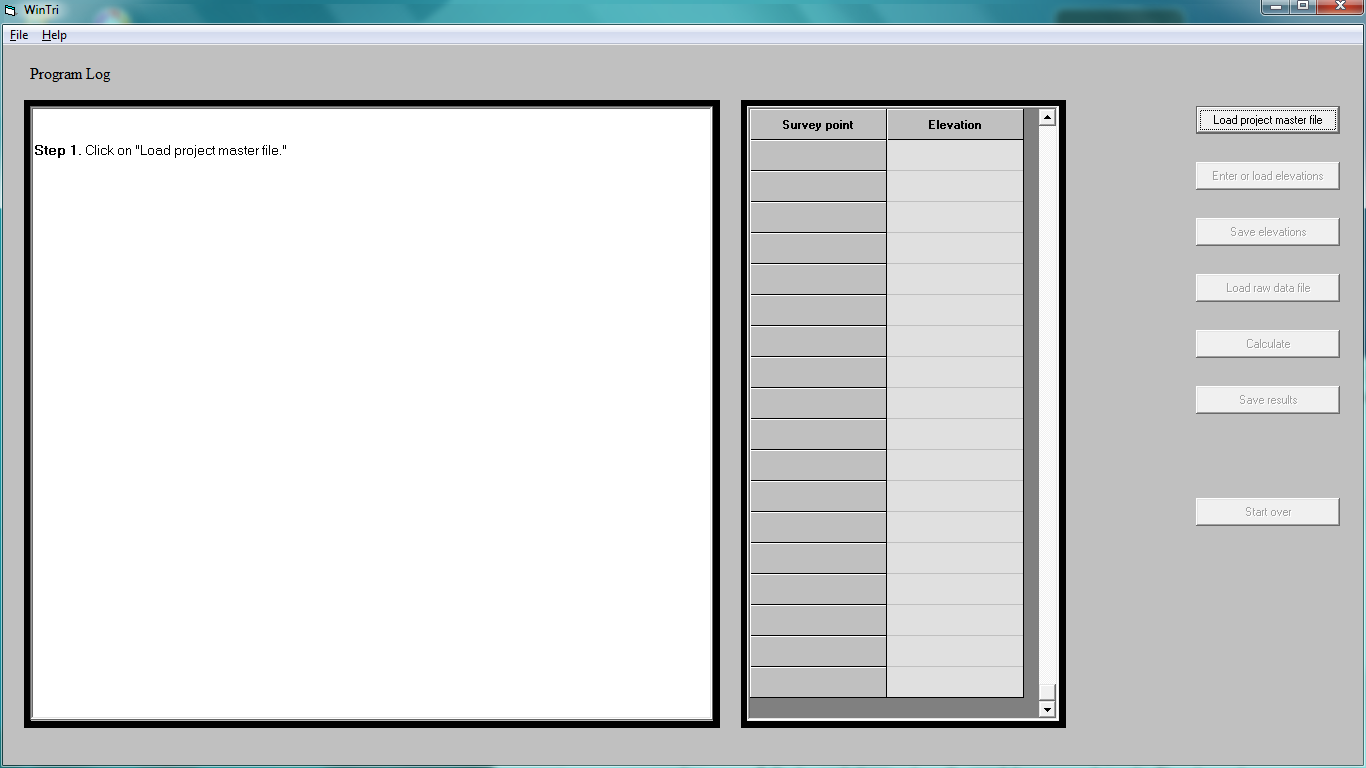
This trilateration surveying data processing program is simple to use. Aside from Help screens, the program displays only three screens. The first screen is the title screen, and the second is a screen with a single message directing the first-time user to the appropriate help screen designed for beginners. The third screen displays seven command buttons: (1) Read master file, (2) Enter elevations, (3) Save elevations, (4) Read raw data, (5) Calculate coordinates (of stations), (6) Save results, and (7) Re-start. The buttons are enabled and disabled automatically as the program user proceeds through the various steps of the analysis. The “Save elevations” button allows the user to interrupt hand entry of elevation data, stop the program and subsequently start the program at a later time without having to re-enter those elevations that had already been entered.
Besides the command buttons, the third screen contains a textbox labeled “Program Log.” If a step in the operation of the program is successfully completed, the program log displays a message to that effect. If an error occurs, then the log displays a message describing the error.
A Screenshot of WinTri – A Trilateration Surveying Data Processing Program
The image below shows a screenshot of the introductory screen of WinTri a trilateration surveying data processing program.
Figure 1. Screenshot of WinTri, a Trilateration Surveying Data Processing Program
The Source Code for WinTri – A Trilateration Surveying Data Processing Program
In addition to an executable module that can be installed and run, the source code, consisting of about 5000 Visual Basic 6.0 statements is provided in case the user wants to revise the program to meet specialized needs. The program is thoroughly documented with commen” are used throughout so that much of the code reads like ordinary English.
Anyone involved in trilateration surveys should find the program helpful. It is easy to learn, it can be used for any control network that the user specifies, and – most important of all – it greatly lessens the tedious and time-consuming task of locating and identifying errors in the survey data.
Reference
Rossow, Mark, Trilateration Surveying Data Processing, An informational blog article.

